
Greenspace Voxels
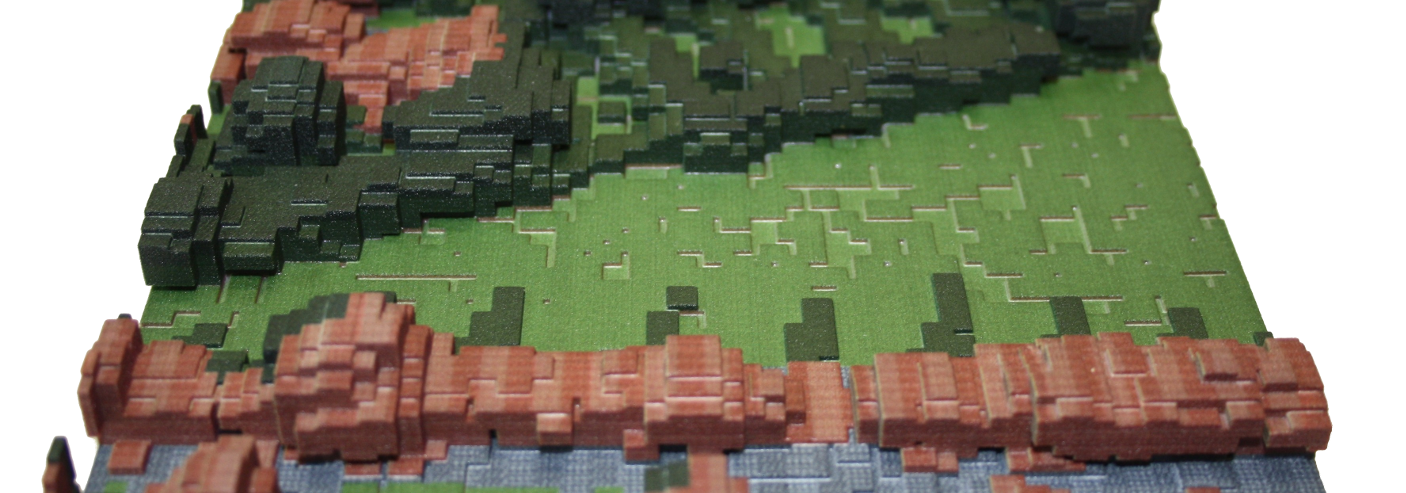
This project involved visualising greenspace in cities in 3D using minecraft and physical models, using voxel data from full-waveform LiDAR (laser scanning landscapes from aircraft). This work has since been published in the journal Landscape and Urban Planning.
We worked with Karen Anderson at the University of Exeter who applies remote sensing to environmental monitoring. Together we played with different ways of exploring the data they were collecting from flights over cities using LiDAR.
We looked at ways to visualise only the greenspace in cities, with all the buildings and roads removed. From an environmental research perspective, looking at greenspace in three dimensions allows a new, more complete perspective on habitat connectivity and the use of space by wildlife. From an urban planning and architectural perspective understanding the impact of a new build on a landscape in three dimensions provides a valuable tool for moving towards sustainable practices.
More photos are available.